Pages

Connecting with Nature through our Trails in Delaware County

Click here (not above) for a full-size, printable .pdf of the map.
Delaware County is unique in that it is the most diverse county of all the counties in ethnicity, history and economic development. Much of the area is densely populated with towns, city, suburban sprawl, and modern development, while farms and rural areas still exist and wildlife and native plants a trees remain abundant.

The best way to view the County as it once was is through glimpses of the development of our County in the 21st century. Whether a resident or a visitor, an experienced hiker, lover of nature, or a casual walker, you will find many places to explore, walk, bike, hike and even canoe and kayak.

Delaware County is also home to multiple segments of the Circuit Trails, a regional network of multi-use trails in Pennsylvania and New Jersey. Currently, there are more than 320 complete miles on the Circuit, and when it is complete, the full network will include more than 850 miles of interconnected trails across our region.
Click here to visit the Circuit Trails website.

Enjoy the experience!

Destination Delco Tourism Bureau

Brandywine Museum of Art River Trail

Alluvial Forest
The river trail begins at the corner of the parking lot near the Museum on the river side. The walk goes from this starting point to the meadow across from the John Chads House. The distance is approximately one mile round trip, or 20 to 30 minutes walking at an average pace.

The trail meanders through an Alluvial Forest with native trees, shrubs and plants and wildlife that includes blue herons, great egrets, northern water snakes and musk turtles.

Just beyond the bridge at Route 1 is a stone mill dam used to channel water from an 1864 grist mill which has been converted into the Museum.

A boardwalk takes you across a wetland area where from an observation deck you can view wood ducks, Carolina wrens, herons and osprey.

Beyond the platform is a floodplain meadow with native grasses and wildflowers.

You can cross the meadow to reach the Chad Ford Historical Society Visitor's Center and the John Chads House.


For more information:
brandywine.org/brandywine/campus/river-trail


Chester Creek Trail

The Chester Creek Trail is a proud member of the Circuit,  a 750-mile network of bicycle and pedestrian trails connecting people to jobs, communities, and parks in the Greater Philadelphia Region.  For more information, visit: connectthecircuit.org
Pet friendly • Biking • Walking • Hiking • Interesting terrain
The Chester Creek Trail is a rail-trail in central Delaware County, Pennsylvania.  The trail will follow Chester Creek along the Civil War-era Chester Creek Branch line of the Pennsylvania Railroad.

When complete, the trail will run
from the former SEPTA Wawa R3 station to Upland, PA. The middle section of the trail, consisting of 2.8 miles through Middletown and Aston townships, was the first to be completed in late 2016.  An official ribbon cutting ceremony was held on April 8, 2017 for Phase I.  Engineering design work  for the next phase, which will bring the trail farther into Aston township, is expected to begin in late 2017.

Parking is available on Lenni Road near Lungren Road.


Crum Woods Trail

The Crum Woods of Swarthmore College is one of the last remaining forested areas in Delaware
County, Pa. With roughly 3.5 miles of walking trails extending over more than two hundred acres of land, the Crum Woods is significant not only for its large area and biodiversity, but also for the opportunities it offers for learning and recreation. The woods are used as a classroom and laboratory by the College, and provide recreational opportunities for all, including the broader community. 
Visitors are encouraged to wander the trails, observe the flora and fauna, and otherwise explore, contemplate, and enjoy the woods.

Though surrounded by a suburban community, the trail
offers visitors beautiful fauna and abundant wildlife.
Crum Creek, which runs north to south through the woods, was originally called Ockanickon, by the native Lenni Lenape who lived on its banks. Following European settlement in the early 18th century, the Swedes renamed it Crumkill, meaning “crooked creek.” Over time,  much of the land around the creek was cleared for agricultural and industrial use. During the Great Depression, under direction of the Scott Horticultural Foundation (which is today the Scott Arboretum) the Crum Woods was replanted with over 60,000 native trees and shrubs. John Wister, first director of the Arboretum, named the trails for acclaimed botanists and horticulturists. The trail names on this map match those on Wister’s 1939 hand-drawn map.

The trail is a “walking trail” and part of the  38 sq. miles of watershed that runs from Malvern, Chester County to the Delaware River. Starting points would be either at Plush Mill Road in Smedley Park or Yale Road in Swarthmore.

The Leiper-Smedley Trail is a paved 2.2 mile path from Rogers Lane to Yale Avenue on the west side of the creek. That trail is bike and handicapped friendly.

107 Yale Road
Swarthmore, PA 19081
610-543-499

Darby Creek Trail

Photo by Grant Myers


Photo by Michele McCandless
The Darby Creek Trail winds along a wooded creek through the western neighborhoods of Haverford Township, just outside of Philadelphia. The trail's southern end is anchored by Merry Place, a playground and nature area

The paved mile-long trail is part of a massive effort in the Philadelphia region to create a 750-mile network of interconnected trails called The Circuit.

Parking and Trail Access

Parking is available at the trail's southern end in Merry Place (600 Glendale Road); the playground and nature area are part of Glendale Park.
nestled within Glendale Park.

Darby Trail
600 Glendale Road
Haverford, PA

Darlington Trail

Though the trail is pet friendly, the railroad bridge crossing over Chester Creek
may be daunting for dogs or young children
The Darlington Trail is most
accessible from the parking lot on Darlington Road. The trail follows Chester Creek for several hundred yards, crosses and follows an old railroad right-of-way, and then crosses portions of the Darlington Family Dairy through mixed woods. meadows and farmland, returning to Darlington Road or continuing on a similar perimeter trail. The loop is approximately 203/4 miles and the terrain is varied with flat and steeper sections that provide excellent views of Chester Creek.

The trail links to the Rocky Run Trail with a portion of it on the Wawa Preserve that is a property maintained by Natural Lands Trust. The grounds that follow the Creek are maintained and planted by the CRC Watersheds Association, a non-profit that manages the Chester, Ridley and Crum Creek watersheds.

The Rocky Run Trail intersects with the Darlington Trail and runs along Chester Creek and the railroad track and has few incline and is very flat.
 

Goshen Road Trail

Photos by: jmcginnis 12@gmail.com
One of the end points of the trail
is the parking lot at the West Tavern on Rt. 352
The Goshen Road Trail runs through Newtown Goshen Road, just west of Route 252 to Goshen Road/Echo Valley Lane.The route, which parallels the south side of the roadway, is separated from traffic by a wide barrier of trees and offers some moderate rolling hills.
and is just shy of a mile, the crushed-stone trail offers a great place for a quick run. It extends from

The trail offers interesting views of old homes, barns and landscapes, and is wheelchair accessible, and suitable for trail bikes, runners, and pets.
N Newtown Street Rd.
Newtown, PA 19073
(610) 356-0200
Click here for more info and photos

Haverford Walking Trails

Haverford Heritage Trail

The Haverford Heritage Trail is a 14-mile loop through Haverford that highlights many (though certainly not all!) historic sites in the Township. It comprises parts of other trails listed below. For a complete map click here.

Haverford Heritage Trail
Follow the trail loop on foot or on bicycle as it winds through the township and its history. Over thirty
sites are numbered starting at the Grange Estate in the southeast part of Haverford and skirt the early 20th century neighborhood of Penfield toward Nitre Hall in Powder Mill Valley, talk the site of the

Small marker signs, bearing the Heritage Trail logo shown above, are placed along the route to help you stay on track. Look for them on street sign and traffic sign posts, and on trees along off-road trails.

The Federal School is a fieldstone one-room school. A 1797 date stone
is on the gable end away from the chimney. Haverford Township's first
purpose-built school and Delaware County's second, it served as
a school until 1872.
In addition to the main trail route, several “option“ routes cover additional sites. Option trails exist for Beechwood Amusement Park of 1907, Haverford College, Steel Road (on-road option for bicyclists) and the Narberth estate.
Beechwood Amusement Park of 1907, and travel all the way to the trails of the Haverford Reserve, the Darby Creek and beyond. But you can start anywhere and cover as much or as little as you want. Fifteen parks are also included. Note: At the present time, some trail portions do not yet offer a continuous route. Specifically, the creekside trail segments along Darby Creek above and below West Chester Pike do not connect with each other. You can start at Site 25 (Lawrence Cabin Original Site), or at Merry Place or Steel Field in southwest Haverford Township, and go counterclockwise on the trail map from there.
 (Click here for map)
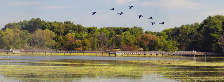
Haverford Reserve

Besides its playing fields, playground and Dog Park, the Community Park at Haverford Reserve
contains more than five miles of popular trails. They are comprised mostly of unimproved paths through woods and a meadow, many with varying levels of steepness. They are available for walking, jogging, off-road bicycling, and even cross-country skiing in winter when conditions permit. Part of one trail (Southbrook) is paved, level and fully accessible. The Reserve trail system is very enjoyable and fun to explore. For more details and a map of all trails  click here.


Haverford College Trail

Haverford College welcomes visitors to its campus. The serene two mile Nature Walk loop (a mix of gravel, dirt, woodchip and grass surfaces) is popular with hikers, joggers and leashed dogs. Bikes are not allowed on the Nature Walk, but may be used on the extensive campus walkway and road system. At the northern edge of the campus, near where College Avenue meets Railroad Avenue, you can walk across the pedestrian bridge over the road to access the quiet Meeting House Walk. Paved with very large flagstones, it leads to Haverford Friends Meeting House and Buck Lane. To see a map click here.
The Powder Mill Valley Monument, erected in 1947 by the Haverford
Township Historical Society, memorializes the early mill history of
this secluded creek valley.

Powder Mill Valley Trails


There are a number of trails in the historic Powder Mill Valley along Cobbs Creek. The popular Karakung Trail and its northern extension provide a more scenic and safer off-road alternative to Karakung Drive for those on foot. Other trails (plus some road sections) on the east side of Cobbs Creek can be combined with these trails to form walking and running "loops" of various lengths. In addition, Karakung Drive itself is closed to motor vehicle traffic on Sundays from May through October for recreational use between the Beechwood Bridge and Manoa Road. South of Manoa Road, there are trails on both sides of the creek, including the Grange Estate.

Darby Creek Walking Trails

There are three basic segments of trail along Darby Creek (all shown in orange), each about one mile long. At this time, they are not connected to each other. They are easy, level walks. The Center Segment, from Merry Place on Glendale Road to Hilltop Road (just south of West Chester Pike), is a hard-surfaced, multi-use trail that is fully accessible and also great for baby strollers. For more details on the Darby Creek Trail click here.

Pennsy Trail

The Pennsy Trail, whose name harkens back to the former Pennsylvania Railroad, turns an abandoned branch rail line corridor into a useful and positive community asset, linking the Skatium and nearby neighborhoods to the Haverford Area YMCA and the pedestrian-friendly signaled crosswalk at Eagle Road. For more detail, click here.


Keller Williams Realty "Red Day" volunteers helped with the initial making of the Pennsy Trail.

John Heinz National Wildlife Refuge Trails

The John Heinz Wildlife Refuge encompasses 1000 acres spanning Philadelphia and Delaware County. It is tucked away near Philadelphia International Airport and preserves and protects the environment in this fragile portion of the Darby Creek. This site contains the largest remaining freshwater tidal wetland in the entire state.

Section of trail on the south-east end of the refuge
With more than 10 miles of trails, the refuge provides many areas for visitors to explore. Environmental education, interpretation, wildlife observation, photography, and fishing are all provided via access throughout the refuge’s extensive trail system. Kiosks and signs provide interpretive materials for trail users.

Within the trail, there is a 3.8 mile loop that features a lake and is accessible for hikers of all skill levels. Trails are open all year round from sunrise to sunset and leashed dogs are welcome. The trail features both paved and gravel surfaces, making it ideal for walking, jogging or cycling. The Heinz Refuge Trail is also part of the Circuit Trails network – trail planners and developers have identified a number of areas in which future trails can be constructed so that this existing trail can connect directly to the increasingly expanding system.

At the Visitor Center, refuge staff and volunteers are available to provide you with helpful information, including maps, brochures and checklists. There are also a number of exhibits to enjoy and a short film to view. Binoculars and fishing rods are available to borrow at the visitor center front desk.

Trail heads are located on the east and west end of the trails.

Darby Creek

The 4.5 mile segment of Darby Creek that flows through the John Heinz National Wildlife Refuge at Tinicum is unique and scenic. It winds through the largest freshwater marsh in Pennsylvania, which allows canoeists to see a variety of plants and animals. The refuge waters are tidal and navigable only within 2 hours before and after high tide.

Canoe and Kayak Trail

The Center invites you to take the following canoe tour of the refuge! As you enter the creek at thecanoe launch, you may see Canada geese feeding in the fields or a northern harrier (marsh hawk) soaring over the marsh. In the creek, you may see the eastern painted turtle or the state-endangered red-bellied turtle sunning on a log or rock. Hooded mergansers, pintails, shovelers and mallards are a few of the ducks that you may pass. Least bitterns, great egrets, black-crowned night herons and yellow warblers are among the species which nest on or near the refuge.

Muskrats, opossum, deer and raccoons are present as well, though some may be more readily seen at night. In spring, you will be treated to an array of wildflowers and migrating birds. By late spring and through the summer, the young birds will fledge and mature. In the fall, the influx of migrants is repeated. Even in winter, there is wildlife to see.

A canoe map is available that points out 10 places of interest you can view from the water, providing a memorable vision of this part of Delaware County.

John Heinz at Tinicum
8601 Lindbergh Blvd.
www.fws.gov/refuge/John_Heinz/

Hours: Open today · 6AM–9PM

Leiper-Smedley Trail

On the AllTrails.com website, reviewers give the Leiper-Smedley Trail in Wallingford 4.5 stars and designate sit as easy. The Leiper-Smedley Trail is a 4.8 mile moderately trafficked out-and-back trail that is good for all skill levels. The trail is primarily used for hiking, walking, trail running, and nature trips and is best used from March until December. Dogs are also able to use this trail but must be kept on a leash. Parts are  paved (south of Baltimore Pike) and going north on the Pike are single tracks worth checking out.  It’s location near the Blue Rt. makes it noisy, but a chance to see the historic Leiper House and Smedley Park make it interesting.  An issue worth noting is that it crosses Baltimore Pike at a red-light intersection. You can also access the other side of Crum Creek by taking Wallingford Road for a good forest trail.

The Thomas Leiper Estate, also known as Avondale, is a historic estate that was built by Thomas Leiper around 1785, and named Strath Haven after Leiper's birthplace in Strathaven, Scotland. The estate includes a three-story, yellow stuccoed mansion house, “Fireproof” vault, communal outhouse, barn, carriage house, smokehouse, warehouse, tenant's house, and a quarry. It was added to the National Register of Historic Places in 1971. The Friends of the Leiper House offers weekend guided tours of the house from April through December.


Smedley Park was named after Samuel L. Smedley, the founder of Delaware County's Parks & Recreation Board. Conveniently located on 120 acres of land between Media and Springfield, Smedley Park has been transformed in recent years into a multi-purpose recreational area while still maintaining all of its natural beauty. The grounds feature shaded picnic groves, safety-conscious play areas for children, hiking paths, walking bridges over Crum Creek, and playing fields for baseball, softball, soccer, and lacrosse. Nestled among the trees are the Environmental Center and the Lewis House, headquarters of Penn State's Cooperative Extension of Delaware County. The extension operates numerous programs, including the 4-H Club, Master Gardeners, and a variety of educational opportunities in agriculture, horticulture, nutrition and more.
ill levels. The trail is primarily used for hiking, walking, trail running, and nature trips and is best used from March until December. Dogs are also able to use this trail but must be kept on leash. Parts are  paved (south of Baltimore Pike) and going north on the Pike are single tracks worth checking out.  It’s location near the Blue Rt. Makes it noisy, but a chance to the historic Leiper House and Smedley Park make it interesting.  The only note is that crosses Baltimore Pike at a red-light crossing.  You can also access the other side of Crum Creek by taking Wallingford Road for a good forest trail.

Newlin Grist Mill

Newlin Grist Mill offers 8.5 miles of trails that blend natural beauty, environmental diversity, and cultural history. The trails pass through an array of diverse habitats from  upland grasslands to river bottom wetlands, each offering its own varieties of plants and animals.

7 trails offer different views and experiences:

Industrial Trail – 1.6 miles, easy

Offers a walk through NGN’s forgotten industrial past.  Following the Octorara Railroad, it passes the Markham Station (Visitor Center), railroad bridges, site of a cannery and creamery.  Today it is home to a variety of plants and birds.

The Osage Trail – 0.8 miles, moderate
Named for the distinctive 100-year-old trees along it’s edges, it is a living connection with prehistoric megafauna like mastodons and giant sloths which used them as a food source.  These trees form a natural tunnel along its edges.

The Beech Trail – 0.8 miles, moderate

This trail offers paths through the grove of Metasequoias, trees known only as fossils until 1949. This native hardwood forest is populated with Beech, Oak, Hickory, Maple and Poplar.  Forest-loving species like nuthatches, woodpeckers and titmice are found here and the hillside is a good place to see native wildflowers in the spring.

The Sequoia Trail – 1.4 miles, easy

This trail offers paths through the Metasequoia grove, a tree only know as fossils until
Features
Pet friendly • Fishing • Picnic areas • Tours • Working Grist Mill
Fishing Pole Rentals
1949.  Explore the former Christmas Tree Farm that is now a mature conifer forest.

Forest Trail – 1.2 miles, moderate

This winds through a series of forests and grasslands.  The forested areas were farmland in the early 20th century and since have been reclaimed by nature.  White-tailed deer, red fox and bluebirds are seen in this area.

Mill Race Trail – 0.9 miles, easy
The trail gets its name from the races (canals) that carry water to the Grist Mill.  Explore the dams, gates, and races that regulate and deliver water to the water wheel.  Along the trail are the Beech Forest and Frog Pond.  Woodpeckers, chickadees, wrens, and warblers are seen on this trail.

Creek Trail – 1.1 miles, easy with stepping stones
Hike along the waters of the Chester Creek and Concord Creek using three stepping stone crossing. Walk through a streamside forest dominated by Sycamore trees, and visit NGM’s reforestation areas.  Kingfishers and herons can be seen fishing in the stream.


Trout fishing has become a well-loved and enjoyable feature of the park.

Both pond and stream fishing are available from the opening of the Delaware County, Pennsylvania trout fishing season through October, conditions permitting.

Stop in the Visitors Center pick up the newest Trail Map Brochure.
Newlin Grist Mill
219 Cheyney Rd.
Glen Mills, PA 19342-1333

610-459-2359
newlingristmill.org

Radnor Trail


The Radnor Trail -- also known as the P&W trail -- runs along what was once part of the corridor for the Philadelphia & Western Railway Company (P&W). P&W maintained the line until 1956, and then it became and remained abandoned until the early 2000s, when it was renovated and turned into the now-popular multipurpose Radnor Trail, where local residents can enjoy some of their favorite outdoor recreational activities. Utilized year round, the trail has been a welcomed addition to the list of highly valued recreational facilities of Radnor Township. Please refer to the Trail’s list of user recommendations on etiquette and responsibility.

There are 7 entrances to the trail including : Brook Road,
Conestoga Road, Gallagher Road,the John Cappelli Golf Range,
Radnor Chester Road, Sugartown Road,
and West Wayne Avenue 

Features & Amenities

The 2.4-mile trail runs from Radnor-Chester
Road to Sugartown Road at Route 30. With several key connections located along the part-macadam, part-crushed stone trail surface, trail users can walk, run or cycle through this serene, wooded area en route to local retail centers and residential neighborhoods. Located in proximity to other Circuit Trails, future plans include extending this route to connect with the Chester Valley Trail and Valley Forge National Historical Park to the north, and the John Heinz Refuge Trails to the south.


A parking lot with a temporary restroom is available at the Conestoga Road entrance to the trail and along Brooke Road. Dog walking is permitted on the trail, though all dogs must be on a leash.
Radnor Trail
520 Conestoga Road
Wayne, PA 19087

Contact: 610-688-5600

Hours
Dawn to Dusk 

Ridley Creek State Park

Fishing • Biking • Hiking • Picnic
Horseback riding • Colonial Plantation
Ridley Creek State Park is a 2,606-acre state park that resides in Edgmont, Middletown and Upper Providence Townships. The park, about 5 miles north of the county seat of Media, offers many recreational activities, such as hiking, biking, fishing, and picnicking. Ridley Creek passes through the park. Highlights include a 5-mile paved multi-use trail, a formal garden designed by the Olmsted Brothers, and Colonial Pennsylvania Plantation, which recreates daily life on a pre-Revolutionary farm.

Ridley Creek State Park has 12 miles of hiking trails and is
pet-friendly. The creek is stocked with trout by the Pennsylvania Fish and Boat Commission. with a portion of the creek designated as a catch and release area for fly fishing only..

5 miles of the trail is designated for multi-sue and open to jogging, biking and walking. There is a wheelchair accessible fishing platform on a multi-use trail.